How to organise your next sailing routes

To the majority of sailing enthusiasts, sailing is nothing short of an art form. An expression, a way of life, you name it, but one thing is certain – whether you have a desire to sail the Mediterranean routes, or any other route in the world, it’s safe to say that a certain amount of advance preparation is required in order to ensure a successful and a more enjoyable trip.

Planning may be a nuisance at first, especially for beginners, but later you will realize that good organisation is fundamental, helping you to sail straight with the wind, never against it. If you want to spend your next summer on a sailboat, sailing the beautiful bay and blue waters of Montenegro, take a look at some of the advice we’ve prepared for you, which will allow you to anchor all the more easily.

Three major factors for successful sailing adventures

Once you lift your anchor and leave the port, sailing towards the sunset, you realise you enter a completely different world, operating solely on the command of nature. A world completely out of your control, which is why every experienced sailor understands the importance of detailed planning, or, as the saying goes: “Prior planning promises pleasant passages”.

There are way too many sailing routes in this world to know them all, but certain general rules can apply no matter where you wish to sail, especially concerning the tools and principles that are used in initial stages of preparation.

Pilot charts are an invaluable part of your kit

Differently called weather charts, these “maps” have evolved into something you might call a stunning compilation containing historical averages regarding wind direction and strength, storm frequency and tracks, fog, icebergs, major currents, existing circle routes, etc. In case you plan a longer sailing trip, these charts are usually divided into a three-month per page format, or, if there is a need for a more detailed observation, you can acquire these on a one-month basis.

Most importantly, all of these volumes are categorised by a specific geographic region, which makes it a whole lot easier to organise your trip. Each chart is defined by easily interpreted graphic symbols. For example, wind circles are placed in evenly spaced squares, and each circle is surrounded by arrows that emanate from eight different directions, showing where the wind is flowing. The arrow length is proportionate to the duration of the wind.

Pilot charts are a must when you’re planning your sailing route, especially if it’s a longer and more elaborate one, because the sea has its own set of rules. Also, when interpreting the chart, you should have in mind that, although the thumb line might represent the shortest route, or distance between the two points, be aware that the shortest doesn’t necessarily mean the quickest.

Major current affairs

Every experienced sailor knows the importance of currents, more so that they can make or break your voyage. These sea currents are powerful forces, and every mariner will shape his or her course in accordance with them, to aid, or at the very least, mitigate, their influence. This is not just a matter or speed, or sailing off course, but safety, since any contrary flow can have serious consequences on both the sailboat or the sailing route.

A good example is the Gulf Stream; when it’s flow is contrary to the prevailing winds and the dangerously steep seas occur, or the stream of the current is not consistent, problems happen. For this reason, it is of utmost importance for sailors to have a head start and observe the real-time current, in order to get an objective look on general sailing opportunities, when choosing a route.

Always rely on local experience

Pilot charts with all of their vast historical data accumulated over many years, may hold life-saving statistics from all over the planet, but anomalies do occur, and every mariner should be aware of this fact. The sea is unpredictable, it’s a force to be reckoned with, a natural delight, ever on the verge of amazing you and frightening you at the same time.

If you need long term outlooks, make sure to listen to those more experienced than yourselves. Talk to the mature cruisers, seek their advice, and take local advice at all times – they have seen many storms pass through the area after all, and can recognize the signs.

Modern vs “ancient” (paper) navigation

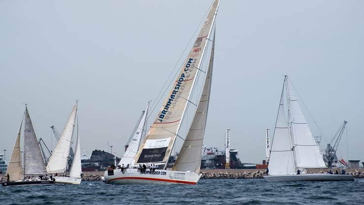
Here comes the great debate, one that seems entirely down to preference. Sure, the electronics allow us to get everywhere we want to go with just a click, and there is no doubt that modern GPS has tamed sailing navigation, and why in the world wouldn’t we use it?

To state that you aren’t wrong for opting for the modern marvels might be the truth, but so is the statement that technology is vulnerable, and always in danger from the most common things such as a power surge – always on a brink of betrayal.

You will never ever get lost at sea if you know the basics of charting and navigating, even if you estimate your position on the smallest of papers. In the end, maybe the best piece of advice is to stick with what you know, whether that is your gadget handling, or your enviable navigating skills.

The tips we’ve tried to illustrate in the simplest fashion allow you to follow the basics and understand the exact steps you need to take in order to organise the best and the safest possible sailing routes, and at the same time, bring the satisfaction of adventure and a window into entirely different world.

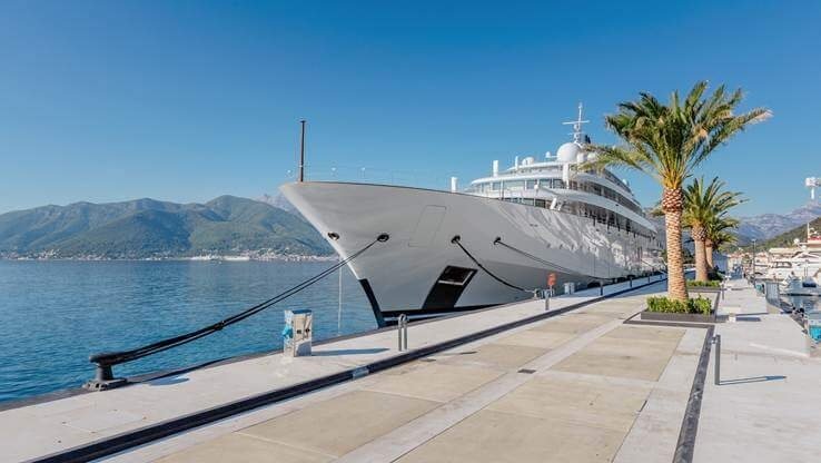
If your wish to sail the Mediterranean, our advice is to discover the ever wild and untamed Montenegro – with its tall mountains, rocky and steep mountain ridges and the royal blue waters topped with a salty foam, inviting you to set your sails towards the horizon.

Start your journey at Porto Montenegro – recharge your batteries, give your vessel a berthing treatment, and nourish your body and soul with proper rest in a luxurious setting. Our marina awaits – whether as a stop on your journey onward or as your homeport of choice!